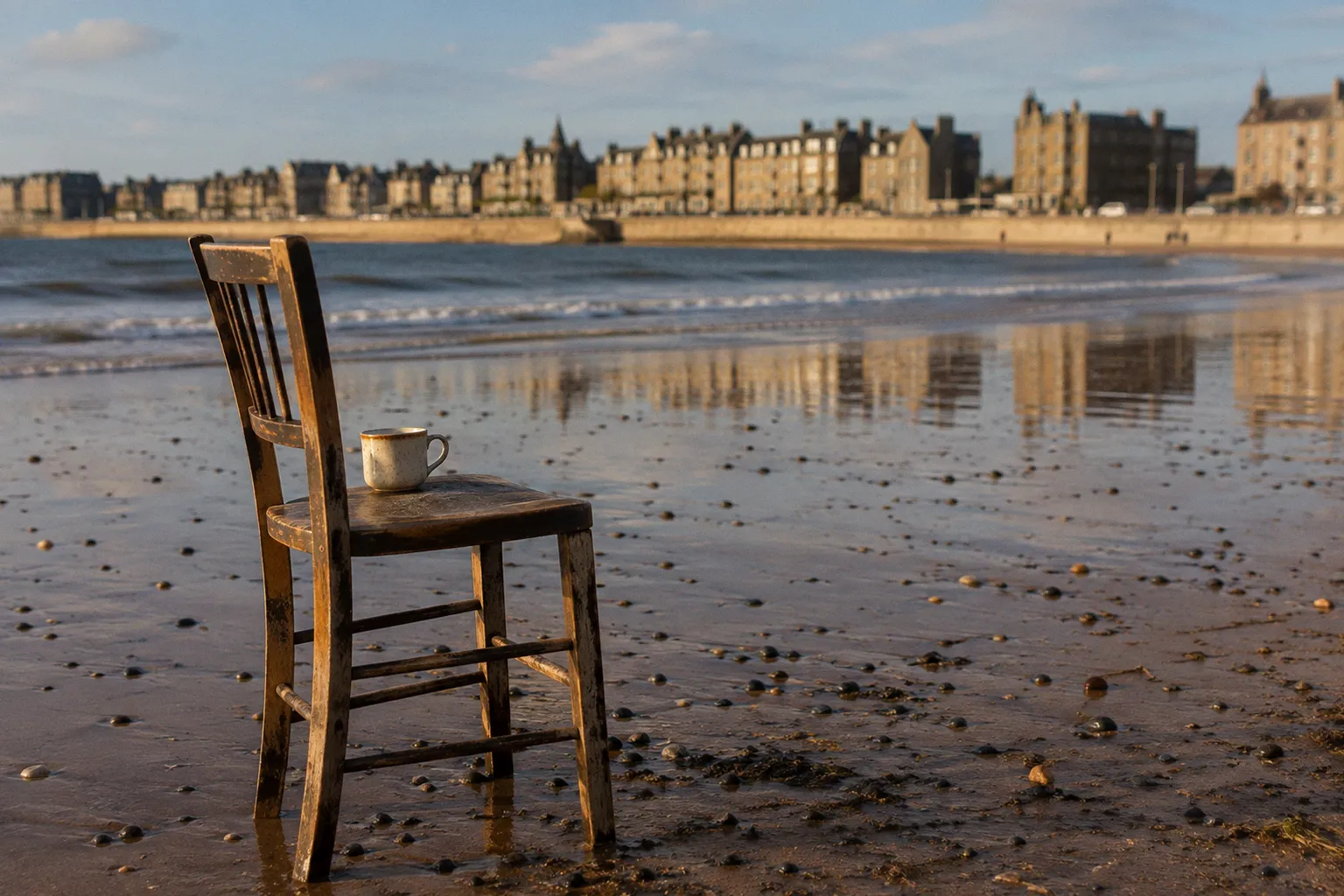
The route traces the southern margin of the Firth of Forth at the precise point where the city of Edinburgh yields to East Lothian, and it does so along a strip of promenade, sand and estuarine mud that has been walked, fished, bathed and paraded since the mid-nineteenth century. It is, in practical terms, one of the most accessible coastal walks in the Lothian region — flat terrain, paved or hard-packed for most of its length, and threaded by a bus service that runs the length of the corridor — and yet it remains quietly underused by visitors who picture Scotland's coast as a sequence of cliffs and headlands further north.
The Victorian promenade at Portobello is not a museum piece but a working public space, its brick shelters and iron railings still serving the purpose they were built for in 1866.
Tracing the Victorian Legacy of Portobello Promenade
The walk begins where Portobello itself begins as a town, at the western edge of a community that was effectively shaped by the seaside boom of the 1860s. The promenade — a broad, formally engineered esplanade running parallel to the high tide line — was constructed in 1866, when Edinburgh's middle classes began treating the coast as a place for leisure rather than labour. What the walker sees today still belongs to that ambition: a wide flagged strip raised slightly above the sand, Victorian brick shelters at intervals along its length, and the iron-and-painted-wood trappings of the kind of seaside architecture that survives across much of eastern Scotland. There is no effort here to imitate Brighton or Blackpool; the buildings are local in scale and material, the shelters built in the same red brick as the tenements a few streets inland, and the whole thing reads as a deliberate civic statement rather than a commercial speculation.
What has changed is the surrounding town. Portobello's heyday as a resort ran from the 1860s through the early twentieth century, and the civic statement of that era survives in buildings like Portobello Town Hall, completed in 1914 on the High Street, which remains the architectural anchor of the community. Today the seafront sits inside a long-established residential neighbourhood — a wynd of closes and stone stairways runs down to the promenade from the older streets behind — and the Victorian bones of the place have been quietly repurposed as cafés, neighbourhood pubs, ice-cream shops and ground-floor workshops. The beach itself is sandy and broad at low tide, narrowing considerably when the firth pushes back in. The promenade is used daily by dog walkers, parents with prams, and the slow traffic of the local open-water swimming clubs who treat the water here as part of their year-round routine.
For the visitor arriving for the first time, the most useful orientation is simply to walk the full length of the promenade before turning east. Portobello Promenade ends not in a formal terminus but in a gradual thinning of the urban fabric — the formal iron railings give way to lower walls, the bath houses and amusement arcades fall behind, and the route takes on the looser character of the Joppa shoreline.
The Shoreline Path: From Joppa Sands to Fisherrow Harbour
Past the last of the Portobello shelters, the path passes through Joppa, a quieter residential edge of the city whose name is older than the resort. Joppa has its own small beach — Joppa Sands — a curve of finer sand backed by low dunes and short stone sea walls, and it marks the point at which the formal promenade peters out into a more informal coastal strip. The terrain here is essentially level throughout. There is no significant elevation to climb, and the surface underfoot shifts between tarmac path, compacted sand and the stone-built sea defences that protect the East Coast Main Line a little inland. This is not a walk that asks for any specialist gear: ordinary walking shoes or trainers handle it comfortably in most conditions.
The shoreline character changes gently as the walker moves east. The wide sandy beach of Portobello narrows and coarsens; the substrate turns more gravelly, with the dark mineral sands typical of the Forth's southern shore. Old timber and stone groynes jut out at intervals — nineteenth- and twentieth-century attempts to slow coastal drift — and these now function less as active engineering than as markers of the long history of trying to hold the line between land and water. The path follows the line of the sea defences closely, and there are stretches where the only thing between the walker and the firth is a low wall and the wind.
Things worth noticing on this middle section:
- The change in beach material from the pale sand of Portobello to the darker, more gravelly shore around Joppa
- The timber and stone groynes, retired from active service but still marking the coastline's shape
- The railway running inland, often visible just behind the sea wall, with frequent commuter and freight traffic
- The narrowing of the urban frontage as Joppa gives way to the more open run-up to Fisherrow
The approach to Musselburgh is signalled well before the town itself becomes visible. The River Esk, which drains much of Midlothian and runs through the centre of Musselburgh, meets the Firth of Forth a short distance west of Fisherrow Harbour, and the path crosses its mouth on a footbridge that gives a clear view of the harbour beyond. Fisherrow is one of the older fishing settlements on this coast: a small working harbour flanked by narrow closes of fishermen's houses and a couple of quayside buildings that have been turned over to leisure use. The harbour's stonework is weathered and patched, and the boats still tied up here are mostly small inshore craft. Standing on the harbour wall, the walker has effectively completed the one-way journey from Portobello: roughly 2.5 miles, or 4 kilometres, on a flat coastal strip with the city behind and East Lothian beginning across the river.
Connecting to the John Muir Way: Scotland's Coastal Spine
For most of the distance between Portobello and Fisherrow, the walker is also on a section of the John Muir Way, the long-distance route that runs for 134 miles across the width of lowland Scotland, from Helensburgh on the Firth of Clyde to Dunbar on the East Lothian coast. The Muir Way was assembled and waymarked in the early 2010s to honour the legacy of the Dunbar-born naturalist and writer, and it knits together a number of older rights of way — coastal paths, canal towpaths, disused railway lines — into a single coherent spine. The Portobello-to-Musselburgh section is one of its quieter stretches: it sits between the more celebrated sections around Edinburgh's city centre and the long East Lothian miles that lead on toward North Berwick and Dunbar.
The practical effect of this overlap is modest but useful. The path is waymarked at junctions with the Muir Way's distinctive logo, and the same surfaces and structures that serve local walkers also serve long-distance users. For the day visitor, the most honest way to read the connection is to notice that this is not a path built for one audience: it carries commuters, schoolchildren, dog walkers, Sunday strollers and the occasional through-hiker all on the same ground. The Portobello-to-Fisherrow section is short enough to walk comfortably in well under an hour, but it carries the texture of something larger — the same view ahead, the same sense of being on a line of travel, that a through-walker would have at mile ninety of a longer journey.
It is also worth noting what the Muir Way connection does not deliver. This is not a remote or wild stretch. It passes close to roads, residential streets and the East Coast Main Line. The skyline is low and populated: the towers of Edinburgh to the west, the bulk of Arthur's Seat inland, the industrial margins of Musselburgh ahead. The walk's appeal rests on this proximity rather than in spite of it — it is the coast as it is actually lived on, not the coast as imagined.
Navigating the Forth Estuary: Landmarks and Logistics
The most striking feature of the walk, and the one that determines its character in any given season, is the Firth of Forth itself. The estuary is broad here — five miles or more across to the Fife shore — and the southern coastline lies open to weather systems moving up the North Sea. On a still morning the water is silver-grey and barely moving; on a windy afternoon the haar can roll in off the sea and reduce the view to a few hundred metres of pale nothing. Neither extreme is the walk's true character. The walk's true character is the long, gradual view, the kind of weather in which the eye can travel.
The Firth of Forth is not a backdrop to this walk — it is the walk. Every turn of the path reframes the same expanse of water, and the day's character is decided by the weather on the firth.
On clear days, the dominant landmark in the eastward view is North Berwick Law, a volcanic plug that rises 187 metres (613 feet) above the East Lothian coast roughly 20 miles to the east. From Portobello it is a low triangular shape on the horizon, sharpening as the eye moves closer to Musselburgh and the angle changes. To the north, across the firth, the Fife coastline reads as a low dark line — the Lomond Hills, when visible at all, only appear on the clearest winter afternoons. Inland, Arthur's Seat and the crags of Holyrood Park form a continuous backdrop above the Portobello tenements. This is a walk with three horizons — sea, hill, town — and the relationship between them shifts with weather, tide and time of day.
The tide matters more than casual walkers often expect. At low water the beach at Portobello and Joppa is broad and firm; at high tide the working surface narrows considerably and the path moves closer to the sea walls. The neap tides — the smallest tidal range in the fortnightly cycle — are the most comfortable walking days; spring tides can push the water right up against the lower walls of the Joppa section and reduce the comfortable margin for strollers to almost nothing. Local walkers learn to read the Forth's tidal rhythm quickly, but visitors should plan their walk around a tide timetable rather than the other way around, particularly if they intend to walk on the sand itself rather than the path above.
Planning Your Return: Transport and Coastal Loop Options
The single most useful piece of information for anyone planning this walk is Lothian Buses route 26, which runs from Princes Street in central Edinburgh through Portobello and on to Musselburgh and Seton Sands along the coastal corridor. Route 26 effectively turns the walk into a linear journey: the walker can begin at Portobello and finish at Fisherrow, or begin in the city and walk as far east as time and energy allow before catching the bus back. The same service handles the return, with stops at Musselburgh's High Street and along the Edinburgh road. This is the route that anyone local to the corridor actually uses, and it is the reason the walk functions as a real day out rather than as a logistical puzzle.
For walkers who would prefer a circuit rather than a one-way trip with public transport back, the obvious option is to walk on to Fisherrow and then return to Portobello along the inland streets and pavements of Musselburgh and Joppa. The full Portobello Promenade–to–Fisherrow–Harbour loop, returning by the inland route, comes to approximately 5.4 miles (8.6 km) and is generally walked in around two hours at a comfortable pace. The return leg is less scenically rewarding than the outward coastal one — it follows suburban roads and pavements for much of its length — but it allows the walker to experience both sides of the corridor and to finish where they started.
The practical kit list for this walk is short. Flat path or firm sand underfoot; no specialist hiking footwear required. Wind is the most consistent discomfort on the route, and a light waterproof is more useful than heavy boots. There are public toilets along the promenade and at Fisherrow Harbour; cafés and refreshment stops are clustered at Portobello's western end and around Musselburgh High Street; the Joppa middle section is the least served and walkers should carry water if they intend to take their time over it. Beyond that, the walk asks little of the visitor except the willingness to look up occasionally at the firth and let the three horizons arrange themselves.
A short comparison of the main route options:
| Route option | Distance | Typical time | Terrain | Best for |
|---|---|---|---|---|
| Portobello Beach to Fisherrow Harbour (one-way) | 2.5 miles / 4 km | Under 1 hour | Promenade and shoreline path | Walkers using the bus back |
| Portobello Promenade–Fisherrow–Portobello (loop) | 5.4 miles / 8.6 km | Around 2 hours | Coastal out, suburban streets back | Walkers starting and finishing at Portobello |
| Extended walk further east toward Seton Sands | Longer, variable | Half day or more | Coastal path, links via bus | Walkers wanting a full day on the firth |
The route between Portobello and Musselburgh rewards a particular kind of attention. It is not dramatic scenery, and it does not pretend to be. What it offers instead is a stretch of coast that has been continuously inhabited and walked for more than a century and a half, and that still carries the social geometry of that history in its layout: the formal Victorian promenade at one end, the older fishing settlement at the other, and the working residential coast in between. The walker who follows it from Portobello to Fisherrow, and then takes the 26 back along the corridor, will have done something quietly useful — they will have understood, in the course of a single afternoon, why Edinburgh has always thought of itself as a city with a seafront.